Changspa Road,Leh Ladakh,India
+91 (99) 0698 6585
Nanda Devi East trek
Trip at a Glance
Trip duration : 21 days tour
Grade : Moderate to Challenging
Activities : 13 days trek
Accommodations: Hotels 9 Nights/ Camp 12 Nights
Journey Highlights
- In Delhi; Rack Shaw ride
- Train journey from Delhi to Kathgodam
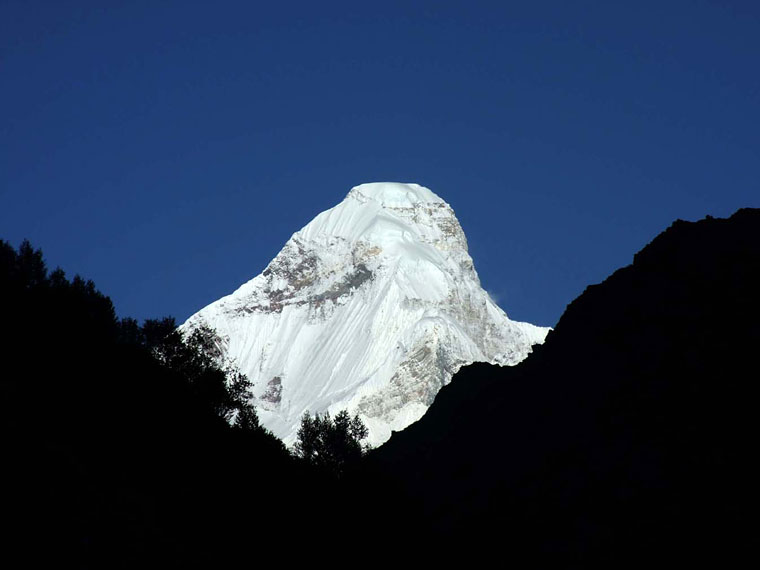
- Glimpse of Nanda Devi East 7334 meter
- Glimpse of Long staff Col 5910 meter
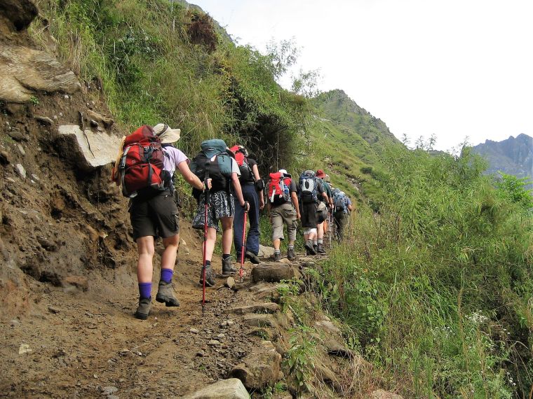
- Trekking in Johar Valley
Tour Inclusions
- Sharing basis accommodations
- In Delhi; Hotel with with breakfast
- Hotels; Almora, Munsyari & Nanital with (AP)
- Potter and horses for luggage, during the trek
- Kitchen crew; including cook and assistance
- All meal while during trekking
- Mention monuments entrances
- Private transport during the tour
- Local guide throughout tour
- Inner line permits for trekking
Tour Exclusions
- Travel insurance
- Single accommodation (available on request)
- Tipping
Meals: B= Breakfast, L= Lunch, D= Dinner
Detailed Itinerary
Day 1 Joins in Delhi
On arrival in Delhi you will be transferred to your hotel.
Standard Hotel
Day 2 Delhi to Katkodam by train
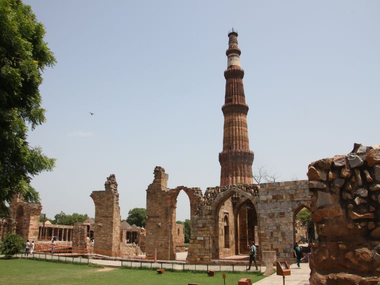
In Delhi comprises of conspicuously contrasting Old and New Delhi. Old Delhi was the capital of Muslim India between the 12th and 19th centuries and one can find monuments such as mosques, and forts related to this Muslim or Moghul history. New Delhi is the imperial city created as India capital by the British. This morning we begin with visit Red Fort, build by empire Shah Jahan. In old Delhi, Chandni Chock, very busy narrow streets, where we are experience the local Rack Shaw ride.
Raj Ghat is the cremation ground of the father of the Nation, Mahatma Gandhi and continues to the Humayun Tomb, which is believed to have been designed in 1565 AD. It is known to have inspired the Taj Mahal and many later Mughal tombs.
Board Ranikhet Express or similar from Old Delhi railway station and reach Katkodam 610 meter early next morning. In India most of the people travelling in the train and them also provided bed for us.
Distance: 282 km
Standard Hotel (B)
Day 3 Drives to Almora
In the morning we reach in Kathgodam 610 meter in Uttarakhand, the foot hill of Indian Himalaya. Our kitchen crew waiting for us in Kathgodam railway station and Later we drive to Almora, a beautiful town, which is located on the hill, in the afternoon, we explore local market and overnight staying in Almora.
Distance: 90km/ 3-4hrs
Standard Hotel (B, L, D)
Day 4 Drive to Munsiyari
Today we drive towards the north of Uttarkhand a small town known as, Munsyari, where we begin our adventure trekking. Today is long day drive or journey and on the way we pass number of villages and towns.
Distance: 190 km
Standard Hotel (B, L, D)
Day 5 In Munsyari 2200 meter
Munsiyari is beautiful tourist places and few tourists opportunity to gets there, due to not easy to accessible. There is small town in Munsiyari, where you can explore, before you begin your trek.
Standard Hotel (B, L, D)
Day 6 Treks to Lilam 1750 meter
From the main bazaar at Munsiyari follow the road heading down, north-east towards to the Johar valley. This road is currently unsealed, while an alternative trail provides some shortcuts to the trail head just above the village of Darkot 1800m
From Darkot, it is a steady decent to the river Gori Ganga. The well-defined trail follows the true right of the river past a series of small villages. There are also several dhabas (Tea house) re-route to Lilam, where we camp for tonight.
Distance: 16km/ 4hrs
Full service Camping (B, L, D)
Day 7 Trek to Bodgwar 2500 meter
In Lilam before we continue our trek we pass by checkpoint of inner line permit to ITBP (Indo Tibetan Broader Police). The trails to Bodgwar continue on the true right of the valley high above the surging water of the river Gori Ganga. After 5km the trail passes the confluence of the river Ralam and Gori Ganga.
Above the river confluence, the trail entire a spectacular gorge where the waters of the Gori Ganga echo and thunder through an incredible series of rapids. The narrow trail is often congested as shepherds lead their huge flocks of sheep and goats to the summer grazing pasture near Milam. The goats are laden with saddlebags carrying potatoes, rice, and seeds etc.
Continue through conifer chestnut and bamboo forest for 4km to the meadow of Bodgwar, nothing more than some shanty huts, an ITBP checkpoints and PWD Rest House. After one kilometre we camp just past the huts to grassy ridge close to the main river.
Distance: 16km/ 5-6 hrs
Full service Camping (B, L, D)
Day 8 Trek to Martoli 3430 meter
Today we follow the river Gori Ganga through a series of meadow gorges and there is a small Hindu temple, beneath a rock overhang 3km past Bodgwar. If you are doing trekking in pre-monsoon the trail crosses a series of snow bridges. Impressive waterfalls cascade down the cliff walls.
The gorge begins to widen 4km or 5km later and after rounding a small meadow the trails splits for about one kilometre, the upper more substantial trails skirts high above a steep rock wall and is suitable only for horses; the lower trail, carved directly out of the rock face, is suitable only for trekkers and porters. This marks the upper limit of the river Gori Ganga Gorge.
The next section of the trail crosses open meadows extending 3km or 4km to Railkot 3100m. The valley veers to the north and 2km beyond Railkot, the first of the high mountain peaks beyond Milam came in to view, giving a test of the scenes to come.
Martoli village is one a grassy plateau high above the confluence of the river Gori Ganga and Lwanl Gad, flowing from Nanda Devi East. In its heyday the village would have supported several hundred people and included a school and shops. At this time there was a thriving trade with Tibet- this ended in 1962, when the border was close following the war between India and China.
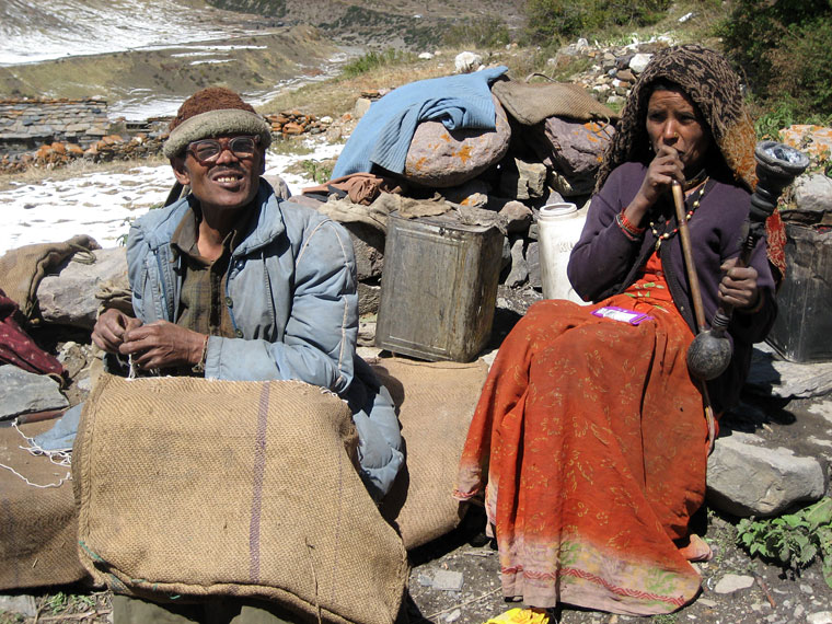
Nowadays Martoli, like so many other villages in the upper Johar valley, is practically deserted, its stone house falling into total disrepair. Only a handful of villagers travel up in the valley from Munsyari and the surrounding villages to spend the summer in Martoli or other villages between there and Milam.
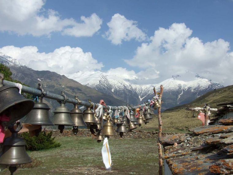
Just above Martoli there is a small stone temple dedicated to Nanda Devi. The temple commands a view up the Lwanl valley to the tip of Nanda Devi East 7434m and the peak of Nanda Kot. To the north, the peaks of Hardeol and Tirsuli can be seen. Outside the temple is an impressive row of bells hanging from climbing rope attached to a prayer wall. The bells are donated by climbing expeditions or by groups of devotees from Munsiyari to placate the goddess of high mountains.
Distance: 14km/ 5-6hrs
Full service Camping (B, L, D)
Day 9 Trek to Milam 3450 meter
This short and easy day offers spectacular views of the Himalaya, including the main peak of Nanda Devi. From Martoli, descend steeply to the bridge over the Lwanl Gad. The trail remains on the true right of the valley for a further 2km until it is opposite village Burphu 3350m. Cross the solid wooden bridge over the river Gori Ganga. Although the trail skirts below Burphu, it is well worth detouring up the hillside to visit the village, one of the most active in this part of the Johar Valley.
Beyond Burphu, several settlements dot the opposite side of the valley. These are handful of shepherds from the Munsiyari district from June until late September. Opposite the settlement of village Pachhu, there are magnificent views of the unmistakable profile of Nanda Devi. Continue past village Belju, form where it is a further 3km to Milam (Mi Lam means man road). The main settlement is just beyond the confluence of the iver Gori Ganga (which flows from the Milam Glacier) and the river Goenka Gad, which flows from the northeast.
Milam was the home of a number of the renowned Pundit explores. It is also the last major settlement before Tibet. In spite of the close association the valley of Milam has with Tibet, they are anxious not to be called Bhotia (the people from Tibet). The villagers trace their ancestry to the Rajput tribes who migrated from Rajasthan in the 12th century to settle in the hills of Uttarakhand. In the 16th century they moved to the Munsyari region and established trading relations with Tibet. Grains such as wheat, barley and rice were exchanged for salt, hardy Tibetan ponies and wool until 1962.
Distance: 11km/ 4hrs
Full service Camping (B, L, D)
Day 10 Trek to Milam Glacier & trek to Pachhu
Milam is as far as we are permitted to trek at present, although the ITBP will allow us to continue past the village for 3km to a vantage point at 3500 meter and here you can marvel at the sheer size and extent of the Milam Glacier. This trail leads you through high meadows dotted with sage, juniper, briar rose and miniature gorse high above the terminal moraine.
Looking towards the head of the glacier, the peaks you will see include Rashi Pahar 6992m, Hardeol 7151m and Tirsuli-I, 7074m. The prominent peaks along the northeast rim include Kholl 6114m, Nanda Gond 6315m, Nital Thaur 6236m and Nanda Pal 6306m.
Later we back to Milam and continue walk opposite side of the Gori Ganga River to village Pachhu.
Distance: 10km/ 4hrs
Full service Camping (B, L, D)
Day 11 In Pachhu; Optional day
Today you have an option day to explore up in the valley, where you can see the peak Latu Dhura 6392m. Or rest or explore around the camp side.
Full service Camping (B, L, D)
Day 12 Trek to Lwanl 3500 meter
It is steady decent back to Martoli. The trail to the Nanda Devi East Base Camp heads west along the true right of the Lwanl Gad. The trail winds above the river for 3km until it opposite the small settlement of Lwanl. This point is high above the confluence of the Lwanl Gad and the tributary flowing in from the southwest (Shalang Gad), which is fed by the snows on the southern ridges of Nanda Kot.
The trail diverts along the true right of the Shalang Gad. Early in the season cross the snow bridge over the tributary. Later, when the snow bridge collapses, villagers from Martoli and Lwanl construct a seasonal log bridge, continue on the true left of the valley to the settlement of Lwanl.
Distance: 13km/ 4hrs
Full service Camping (B, L, D)
Day 13 Trek to Nanda Devi East Base Camp 4150 meter
Continue up the Lwanl valley before entering spectacular gorge country. The trails skirts around side gullies and past rhododendron copses, which remain in bloom until late May. Descend (via the trail) to the river edge to avoid rocky overhangs. After 4km to 5km, the valley widens and offers views of Nanda Kot. The trail passes a series of moraine fields until it is opposite the meadow of Sartol Kharak 3650m. Cross the Lwanl Gad here to the true left of the valley (early in the season there is a snow bridge; later a log bridge).
The trail continues to the meadow Naspanpatti 3850m. A herd of Bharal has been spotted on the cliffs above this meadow so (by association) there is the chance of sighting elusive snow leopards late in the season. The trail ascends high above the terminal moraine engulfing the main valley floor before crossing some screes slopes just below the base camp.
Nanda Devi Base Camp 4150m is delightful series of meadows. There are many campsites from which to appreciate the peaks and the high snow ridge that virtually enclose the upper valley. To the south, a snow ridge links the imposing summit of Nanda Khat 6611m to Changuch 6322m. Before gradually rising to the imposing summit ridge below Nanda Devi East 7434m the highest peak in the vicinity. Along the ridge lies the Long-staff Col 5910m, accessible only by a technical climb, from where it is possible to peer into Nanda Devi Sanctuary. We are quite high with altitude and close to the snowy mountains, so be prepared for cold weather.
Distance: 11km/ 6hrs
Full service Camping (B, L, D)
Day 14 In Nanda Devi East Base Camp 4150 meter
A scramble up the snow ridges southeast of Nanda Devi East offers unrivalled views of the gullies leading to the Long-staff Col and also the route leading to trails Pass, the heavily crevasses pass linking the upper Lwanl valley with the Pandari valley.
Distance: 34km return 3-4hrs
Full service Camping (B, L, D)
Day 15 Trek to Martoli
The return trek back to Martoli can be completed in a long morning, with time to savours final views of the peaks near Nanda Devi East and the summit beyond Milam.
Distance: 15km/ 6-7hrs
Full service Camping (B, L, D)
Day 16 Trek to Bodgwar
From Martoli we are heading, back to Bodgwar via same route.
Distance: 14km/ 5-6hrs
Full service Camping (B, L, D)
Day 17 Trek to Lilam
Today again we follow the same route to Lilam
Distance: 16km/ 5-6 hrs
Full service Camping (B, L, D)
Day 18 Trek to Munsyari
We start early to escape from the heat, trek to Munsyari via same route.
Distance: 16km/ 4hrs
Standard Hotel (B, L, D)
Day 19 Drive to Nanital 1950 meter
Today is long day drive and we taking mostly the same route, once we came from the Almora to Munsyari.
Nanital is attractive hill resort is one of the main gateway for trekking in Kumaon region. The town is centred around the large lake or Tal, hence the name Nanital. In 1839 the town was selected as a retreat for British official, notably at Nanital and Ranikhet.
Distance:
Standard Hotel (B, L, D)
Day 20 In Nanital 1950 meter
We explore around Nanital or lake.
Standard Hotel (B, L, D)
Day 21 Drive to Katkodam 35km & by train to Delhi
In the morning we have short drive to Katkodam railway station, to catch the train back to Delhi. In the train couch, we have a air-condition Chair seat and where you can enjoy the view of real Indian villages and towns. (trip concludes)
Distance: Katkodam - 35km/ Delhi - 282km
Standard Hotel (B, L)


